Introducing Synced's Data feeds And Annotation Trial
As part of our project with Innovate UK and the UK’s Geospatial Commission we have developed new tools for people to crowdsource the state of the neighbourhoods, and data feeds to inform people about the places they live, work and frequent.
The Synced app lets users “mark” places with information. These marks are then shown to other Synced users as they walk past, and to explorers worldwide. Our users can and do mark anything, from amazing places they discovered through to cute cats they came across on their wanders. Once created, a mark can be edited and commented on by other users, and over time marks thus evolve to become the digital representation of a place and its community.
We’re now automatically adding data feeds to marks to give a more complete representation of a place for residents and explorers. We are starting by showing the recently reported crimes at a mark’s location for UK marks.
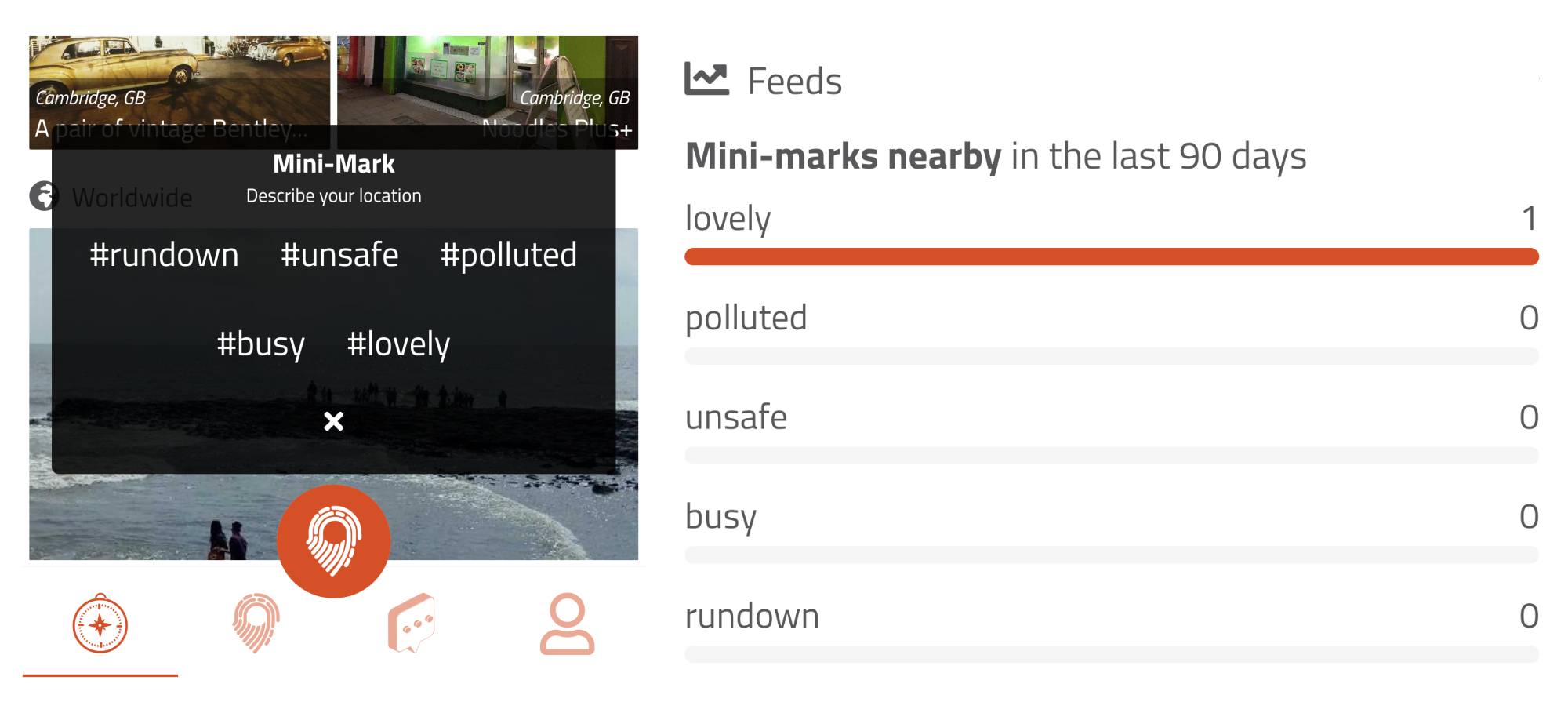
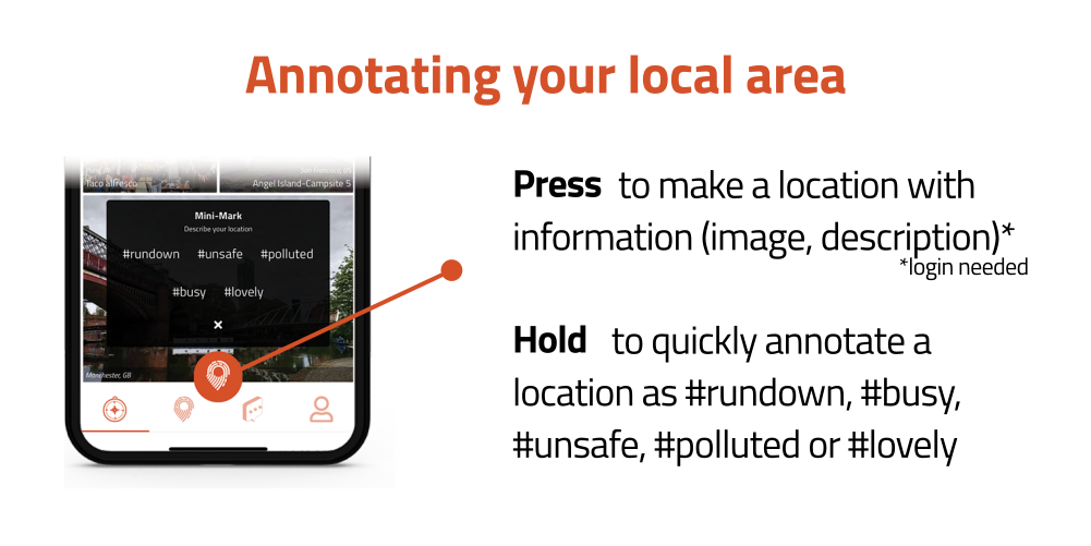
We’ve also added a new crowdsourced feed. Users can add data to a location themselves by using the new mini-mark functionality. By holding the Mark button, locations can be labelled as #lovely, #busy, #polluted, #rundown and #unsafe with more options to come.
We’re currently trialling these features in Cambridge, Oxford and East London. We’ll be updating them based on feedback, and adding more datasets in the coming months to inform residents, explorers and city planners.

Thank you for reading, you can check out our app for exploring meaningful places on the App or Google Play stores.